For current e-ticket instructions use the official Ministry park page. It announced a new booking platform in May 2026; older portal links and previously quoted entry prices below need confirmation for your visit date.
How hard is the Kawah Ijen hike, in one paragraph?
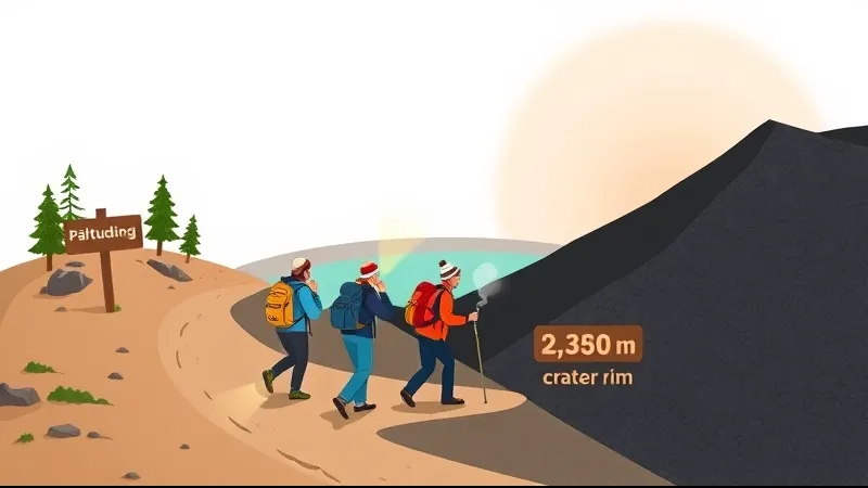
The Kawah Ijen hike is moderate, not hard. From the Paltuding base camp (1,841 m) to the crater rim (~2,386 m) it is about 3 km one way with roughly 545 m of elevation gain, and most people walk it in 1.5–2 hours up and less coming down. The track is wide, well worn gravel and dirt: there is no scrambling, no rope work and no exposure on the main trail. What makes it feel harder than the numbers suggest is that you do it in the middle of the night, in the cold, on very little sleep — and that the final section is noticeably steeper than everything before it. That last stretch is where most hikers struggle, and where most turn a steady walk into a stop-start slog.
Be clear about what you are buying with that effort. The crater rim, the sunrise and the view over the turquoise acid lake are the reliable payoff: they are there whenever the park is open and the weather cooperates. The optional descent to the crater floor to look for the blue fire is a separate activity, considerably harder, genuinely hazardous, and never guaranteed to be visible.
What are the distance, elevation gain and gradient of the Kawah Ijen trail?
The core numbers are simple: Paltuding post at 1,841 m, crater rim at about 2,386 m, roughly 545 m of ascent spread over about 3 km of trail, with the same distance back down. The route is a single obvious track — you cannot really get lost on it, even in the dark, because there is a steady line of head torches ahead of you.
The gradient is not evenly distributed, and that matters more than the total:
- The first third climbs gently through pine and casuarina. It is the easiest walking of the night and the section where people burn energy they will want later.
- The middle third steepens into a consistent, honest grind. Nothing dramatic, but this is where breathing patterns change and conversation stops.
- The final third is the steep part. The gradient rises sharply, the surface turns to loose volcanic gravel, and short pitches feel steeper still.
For geological framing, Ijen is catalogued by the Smithsonian Institution Global Volcanism Program, and the wider area is recognised as part of the UNESCO Global Geoparks network. Note also that the Merapi cone of the broader Ijen complex is a different and harder objective from the tourist rim trail; standard tours do not include it, and nothing in this article applies to it.
Why is the last stretch to the crater rim the hardest part?
Because four things stack up at once. The gradient is at its steepest exactly where the surface is loosest — volcanic gravel that slides slightly under each step and steals part of every push. It is also the coldest and windiest section, because you emerge from tree cover onto an open ridge. And you reach it after several hours awake, having been picked up in the middle of the night.
The fourth factor is traffic. This is the working route of the sulfur miners, who carry loads of ~75–90 kg out of the crater in baskets or push them in carts. The track narrows, and hikers are expected to step aside — repeatedly — to let loaded miners pass. Treat them as workers, not scenery: no photographs without asking, and no blocking the trail.
Practical mitigation is unglamorous but effective:
- Shorten your stride as the gradient increases. Small steps on loose gravel slip less and cost less.
- Walk slowly and continuously rather than in bursts. Stop-start climbing is what exhausts people here.
- Plan short, regular rests — a few minutes every fifteen to twenty, taken before you need them.
- Accept the rim as the finish line. Turning around at the top, without going into the crater, is a complete trip.
What level of fitness do you actually need for Kawah Ijen?
Being comfortable with sustained uphill walking is useful preparation, but a stairs or distance test cannot establish that you will complete this hike safely. Cold, lost sleep, altitude, gas, footing and individual health all matter. Start rested, pace yourself and stop if symptoms develop; discuss fitness or medical concerns before booking.
Altitude can contribute to illness, and fitness does not rule it out. CDC guidance notes that altitude illness can occur below the commonly cited 2,450 m sleeping altitude. A brief visit is different from sleeping at altitude, but the rim elevation is not a diagnostic cutoff. Do not dismiss headache, dizziness, nausea or breathing difficulties as merely cold, fatigue or sulfur smell: stop ascending, alert your guide and seek medical help for severe or persistent symptoms.
If you are currently sedentary, two to three weeks of stair climbing or incline treadmill walking before the trip makes a genuine difference, mostly to your legs on the way down. And if you are simply slow, that is fine: a slower group pace just means starting earlier, which any guide can arrange.
How much harder is the descent into the crater to see the blue fire?
Substantially harder, and it should be treated as an optional bonus rather than the point of the trip. The path down to the crater floor is unmaintained: loose blocks, scree, awkward steps, and a real trip and rockfall hazard, in darkness, while wearing a gas mask that restricts your vision and breathing. It takes well under an hour to descend and appreciably longer to climb back out, and the return leg comes on top of the main ascent you have already done.
The blue fire itself is sulfuric gas igniting on contact with air, with flames that can reach around 5 m, and it is visible only in darkness — roughly between 02:00 and 04:30. It is never guaranteed. Emission rates vary, mining works change, and park authorities suspend and reopen crater-floor access based on gas readings and volcanic activity. Those suspensions have lasted months at a time. Check MAGMA Indonesia / PVMBG and the BBKSDA East Java park authority for current conditions before you book, and treat the rim, the sunrise and the lake as the planned highlights, subject to gas, weather, visibility and access restrictions.
Volcanic gases can affect the rim as well as the crater interior. Ordinary cloth, surgical and particle-filtering masks do not protect against gases. NIOSH guidance for sulfur dioxide requires protection selected for the specific contaminant and exposure conditions; cartridge compatibility, service life and fit matter. A rented mask or a generic “multi-gas” label does not establish adequate protection. Unknown or dangerous concentrations are a reason to leave, never a reason to rely on a tourist respirator.
If you are still deciding whether the crater descent belongs in your plan at all, our comparison of the sunrise hike versus the midnight blue fire trek lays out the trade-off in detail.
What conditions will you face in the middle of the night on the trail?
Cold, dark and damp — three things most visitors to tropical Indonesia do not pack for. Night temperatures at the rim are often between 2 and 10 °C, with wind on the exposed upper section making it feel colder, while the lowlands around Banyuwangi the same afternoon are hot and humid. The swing catches people out every night.
Darkness is total until dawn. A head torch with spare batteries is essential; a phone flashlight leaves your hands full and dies exactly when you need it. In the rainy season, roughly November to April and peaking in February, the trail is slippery and the summit view is frequently clouded over. The dry season runs roughly May to October, with July to September usually the most reliable.
Below the rim sits the reason everyone comes: a crater lake about 1 km wide and around 200 m deep, with a pH commonly measured between 0.13 and 0.5 — the largest highly acidic crater lake in the world. Its turquoise colour comes from dissolved sulfuric and hydrochloric acids and metals, chemistry documented in Delmelle and Bernard's foundational work and in later monitoring research by Caudron and colleagues. For regional weather before you travel, BMKG is the Indonesian meteorological agency's official source.
Who should not attempt the Kawah Ijen hike?
Some of this is official park policy, some is ordinary medical caution. Discuss all of it with your doctor and your operator rather than treating this page as a ruling.
- The park requires a doctor-issued health certificate dated no more than three days before the visit. It advises against hiking with a history of heart disease, asthma, acute respiratory infection or other respiratory disorders. Seek individual medical advice, including during pregnancy; a certificate or mask does not guarantee safety.
- Pregnancy. Strongly advised against by guides and health advice generally; the crater descent in particular. This is a widespread recommendation rather than a written official ban, but it is near-universal.
- Recent surgery, or knee, hip and ankle instability. The steep, loose descent loads joints hard, and there is nowhere to bail out halfway.
- Anyone who cannot tolerate a respirator. If a sealed mask makes you panic, the crater floor is not for you.
- Contact lens wearers should switch to glasses; sulfur gas irritates eyes and lenses trap it against the cornea.
- Very young children should not do the crater descent under any circumstances.
A health certificate is required for entry, and rangers deny access without one — build that into your planning rather than discovering it at the gate. Finally, remember that the rim-only version of this hike is accessible to far more people than the crater descent. Ruling out the blue fire does not rule out the trip.
Can you do Kawah Ijen if you cannot walk the whole way up?
Partly, yes. A trolley or "taxi" service operates on the main trail: modified carts pushed and pulled by local sulfur miners between Paltuding and the rim, sometimes for the full route and sometimes only for the steep upper part. It is arranged either directly at the trailhead or through your guide, one way or return, and the seat is exposed, bumpy and cold.
Two honest caveats. First, rates are negotiated locally and change — we do not quote a figure, and you should confirm the current price on arrival before you set off. Second, this is extremely hard physical labour performed by the same men who carry sulfur out of the crater, and plenty of travellers find that uncomfortable. Weigh it yourself rather than being surprised by it at 02:00.
One practical limit: the trolley reaches the rim, not the crater floor. The blue fire descent is always on foot.
How long does the whole Kawah Ijen trip take, including transfers?
Most of a night and a morning. From Banyuwangi town the drive to the base is about 1–1.5 hours, with pickups shortly after midnight so that groups are on the trail in time for the blue fire window between roughly 02:00 and 04:30. From Bali it is a long overnight trip: about 4–5 hours of driving to Gilimanuk, the ferry crossing to Ketapang taking around 45–60 minutes door to door, then a further 1–1.5 hours to the base.
On top of the transfer, budget 1.5–2 hours for the climb, a while at the rim for sunrise and the lake, and a faster descent. Park entry is by e-ticket only, through tiket.bbksdajatim.org — there are no tickets at the gate. Foreigners pay IDR 100,000 on weekdays and IDR 150,000 at weekends and on holidays, a health certificate is required, and the park is closed on the first Friday of each month. Opening times and last-entry cut-offs are set by the East Java park authority and change, and access is suspended entirely when volcanic activity rises.
For live availability, current departure times and pricing, use the GetYourGuide widgets on our tour comparison pages rather than any figure quoted in an article — including this one. If you are starting from Banyuwangi and want the rim-and-sunrise version, the Ijen sunrise tour from Banyuwangi page is the place to compare options side by side.
What gear makes the hike meaningfully easier?
A short list, each item tied to a specific difficulty named above:
- Trail shoes or boots with real tread. The loose gravel on the final stretch and on the way down is the whole argument against sneakers.
- A head torch plus spare batteries. Not a phone.
- Layers, including a windproof shell. The rim is cold and exposed; the car park is not.
- Gloves and a hat. Small, light, disproportionately useful.
- Water, carried on you rather than left in the van.
- A certified acid-gas respirator if you intend to descend to the crater floor.
Trekking poles are worth carrying mainly for the way down, where knee load is highest and the surface is least predictable. Reputable operators supply masks and torches, but quality varies — inspect the filter type and its expiry date, and test the head torch, before you leave the trailhead.
How does Kawah Ijen compare to Bromo and other Java volcano hikes?
Of the classic East Java pair, Ijen is clearly the more physically demanding. The main Bromo sunrise viewpoints are largely vehicle-accessible, with a short walk and a staircase at the crater itself — feasible for people who could not manage Ijen. Ijen asks for a sustained night climb on foot.
Above both sit the harder objectives: the Merapi cone within the Ijen complex, and Raung, which are longer, steeper mountain days for experienced hikers and are not part of standard tourist itineraries. A rough difficulty ranking for planning: Bromo viewpoint (easy, mostly driven) → Ijen crater rim (moderate, non-technical night hike) → Ijen crater descent to the blue fire (hard and hazardous, optional) → Merapi/Raung (serious mountain hikes). Protected-area status and access rules for each are managed by Indonesia's Ministry of Environment and Forestry through the regional BKSDA offices, and general destination information is published by Indonesia Travel. If you are weighing a combined itinerary, our Bromo–Ijen combo versus Ijen only comparison covers the added driving honestly.
Frequently asked questions about Kawah Ijen hike difficulty
Is Kawah Ijen suitable for beginners?
Yes, for the rim hike. The trail is wide, obvious and non-technical, and no hiking experience is needed. The difficulty is the night start, the cold and the steep final stretch, not the terrain. Beginners should walk slowly from the start and plan to stop at the rim rather than descending into the crater.
Can older travellers do the Kawah Ijen hike?
Many do. Age matters far less than cardiovascular fitness, joint health and pace. If you can walk 3 km uphill slowly without stopping for breath, the rim is realistic. The descent is harder on knees than the climb, so poles help. The crater descent is a different question and generally not advisable.
Do I need a guide for Kawah Ijen?
A guide is standard practice and strongly recommended, particularly for anything below the rim. Guides handle the e-ticket, timing, masks and current access status, and they know when rangers have closed the crater floor. Independent hiking on the main trail happens, but you lose the safety margin the guide provides.
Is the blue fire guaranteed?
No. It depends on gas emission rates, mining activity and current volcanic conditions, and access to the crater floor is suspended and reopened by park authorities — sometimes for months. The rim hike, sunrise and lake are planned highlights, subject to gas conditions, weather, visibility and official access restrictions. Blue fire is not guaranteed.
Can I skip the crater descent and still see the lake?
A rim-only itinerary omits the additional steep crater descent and return climb. It still involves the uphill trail, cold, darkness and possible volcanic gas exposure. Follow official restrictions; a closed descent does not establish that the rim is open or safe.
What happens if the trail closes?
Access is suspended entirely when volcanic activity rises, and the park is also closed on the first Friday of each month. Closures can be announced at short notice. Tours generally reschedule or refund according to their own terms, so check the cancellation policy shown in the booking widget before you commit.
How cold does it get at the crater rim?
Night temperatures at the rim are often between 2 and 10 °C, and wind on the exposed upper section makes it feel colder. That is a large swing from the hot, humid lowlands you left a couple of hours earlier. Warm layers and a windproof shell are needed even in tropical Indonesia.
Is Kawah Ijen safe for people with asthma?
The park requires a doctor-issued health certificate dated no more than three days before the visit. It advises against hiking with a history of heart disease, asthma, acute respiratory infection or other respiratory disorders. Seek individual medical advice, including during pregnancy; a certificate or mask does not guarantee safety.
Sources
- Smithsonian Institution — Global Volcanism Program, Ijen volcano profile — eruption history and volcanic context.
- PVMBG / MAGMA Indonesia — Centre for Volcanology and Geological Hazard Mitigation: current alert level and access status.
- BBKSDA Jawa Timur — Indonesian Ministry of Environment and Forestry regional conservation agency: Taman Wisata Alam Kawah Ijen management, opening rules and closures.
- tiket.bbksdajatim.org — the previously used official e-ticketing channel for park entry.
- UNESCO Global Geoparks — Ijen Geopark designation and geological framing.
- BMKG — Indonesian Agency for Meteorology, Climatology and Geophysics: regional weather and seasonal patterns.
- WHO Global Air Quality Guidelines — sulfur dioxide exposure guidance.
- Wilderness Medical Society — Practice Guidelines for the Prevention and Treatment of Acute Altitude Illness.
- Indonesia Travel — official national tourism information.
- Delmelle, P. & Bernard, A. (1994), Geochemistry, mineralogy and chemical modeling of the acid crater lake of Kawah Ijen volcano, Indonesia, Geochimica et Cosmochimica Acta.
- Caudron, C. et al., published research on Kawah Ijen crater lake monitoring and gas dynamics.
No low-quality blogs or content farms are used as sources for this article. Live tour prices, ratings and availability are not quoted here at all — they appear only in the GetYourGuide widgets on our tour pages, where they update automatically.